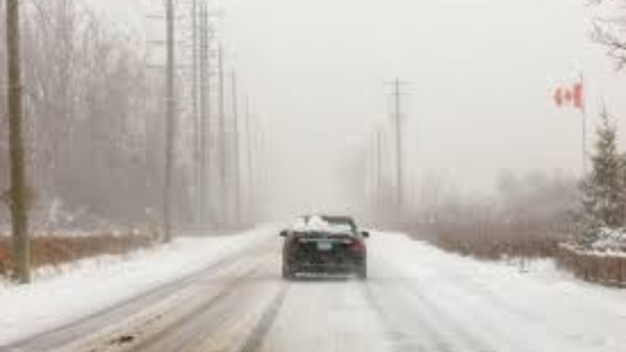
Southern Ontario is currently facing its most significant winter event of the season today, Thursday, January 15, 2026. A major low-pressure system is delivering heavy snowfall across the province, with the worst impacts expected to coincide with the evening commute.
Thank you for reading this post, don't forget to subscribe!Snowfall Projections
The storm is hitting various regions with varying intensities:
- Eastern Ontario & Ottawa: Anticipated totals of 15–25 cm, with heavy snow continuing through the evening.
- GTA & The Golden Horseshoe: Widespread totals of 15–20 cm, with the highest accumulations in Durham and York regions.
- Southwestern Ontario: Localized areas near London and Sarnia may see up to 40 cm due to lake-enhancement.
- Niagara Region: Expect 20–25 cm of heavy, wet snow.
The “Rush Hour Chaos” Factor
Commuters should prepare for a high-stress evening drive. Several factors are contributing to the hazardous conditions:
- Reduced Visibility: Blowing snow is creating “whiteout” conditions on the 400-series highways and the QEW.
- Flash Freeze: As temperatures plumet toward -10°C, slush and ponding water are rapidly turning into black ice.
- Transit Disruptions: GO Transit and the TTC are experiencing system-wide delays, and major airports (Pearson/Billy Bishop) have issued travel advisories due to de-icing requirements.
Looking Ahead
While the system is expected to taper off from west to east late tonight, lake-effect snow squalls will likely develop in the wake of the storm. Residents in the Barrie, Collingwood, and Lake Huron snowbelts should expect additional accumulation and difficult travel through Friday morning.