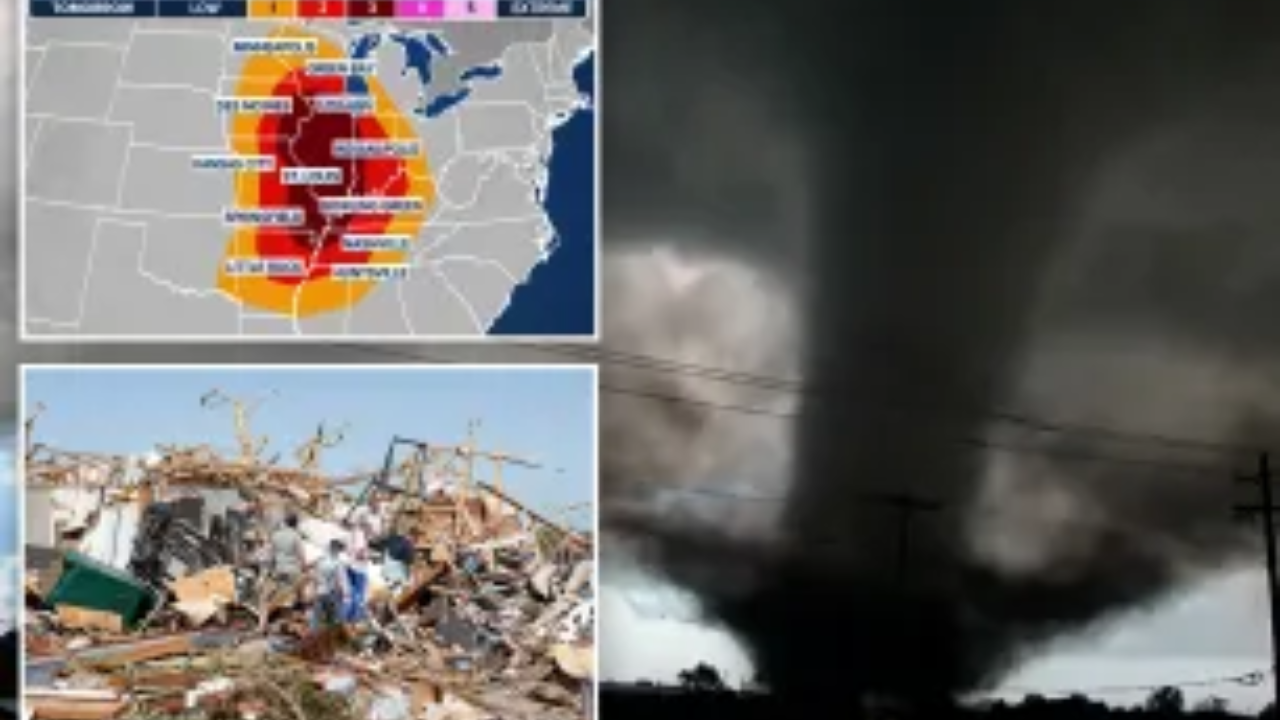
A volatile severe weather outbreak is currently unfolding across the Midwest and Central Plains. Atmospheric conditions have created a “loaded gun” scenario, with the potential for strong, long-track tornadoes, massive hail, and destructive winds.
Thank you for reading this post, don't forget to subscribe!The High-Level Threat
- Primary Hazards: Significant tornadoes (EF2+), “giant” hail (3″+), and 70+ mph straight-line winds.
- Target Zones: High-risk areas include Iowa, Missouri, and Illinois, with the threat expanding as storms track eastward.
- Timeline: The highest risk for intense, long-duration tornadoes is late afternoon through tonight.
Critical Safety Actions
- Know Your Shelter: Get to a basement or a small, windowless interior room on the lowest floor.
- Stay Alert: Ensure your phone’s Emergency Alerts are ON. Don’t rely on sirens—have a NOAA Weather Radio or a battery-powered backup.
- Nighttime Plan: These storms will move through after dark. Keep your devices charged and loud enough to wake you.
- Gear Up: Wear sturdy shoes and use a helmet (bike or sports) to protect against flying debris if a warning is issued.
Why This Matters
April 2026 has already been historically active, including the 83-tornado outbreak on the 17th. Many communities are already dealing with debris and damage; please look out for your neighbors and take every warning seriously.

"Suresh Kumar Saini is an experienced Tax Assistant and finance writer. He specializes in US & Canada Tax Guide, Indian Income Tax laws, GST compliance, and personal finance, helping freelancers and remote workers optimize their taxes."