Environment Canada has issued a special weather statement for British Columbia’s South Coast, warning of unusually high water levels that could lead to flooding in low-lying areas. The peak risk is centered around the morning high tide on Sunday, January 4.
Thank you for reading this post, don't forget to subscribe!Why Is This Happening?
A “perfect storm” of three distinct factors is coming together to push sea levels higher than normal:
- King Tides: We are currently experiencing some of the highest astronomical tides of the year.
- Storm Surge: A strong low-pressure system is moving over the coast. Lower air pressure allows the ocean surface to expand and rise.
- Onshore Winds: Strong winds are expected to push additional water toward the shoreline, creating significant wave run-up.
Expected Impacts
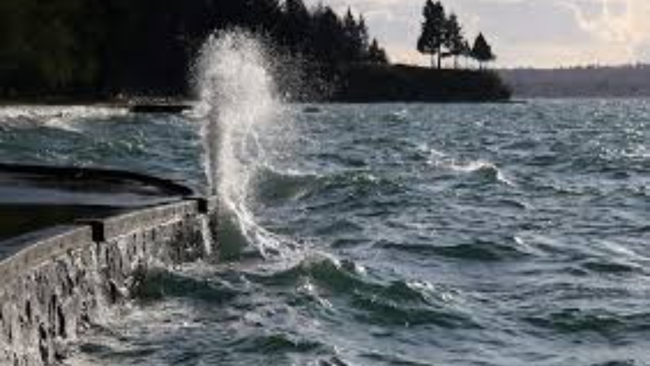
- Seawall Overtopping: High waves and water may breach seawalls and coastal barriers.
- Infrastructure Risk: Possible flooding of coastal roads, parking lots, and basements in low-lying neighborhoods.
- Marine Debris: Expect heavy logs and debris to be tossed onto shorelines and walkways.
- Erosion: Intense wave action may cause significant erosion to beaches and coastal bluffs.
Vulnerable Regions
| Region | Specific Areas of Concern |
| Metro Vancouver | Boundary Bay, West Vancouver seawalls, Locarno/Spanish Banks, and the Fraser River Delta. |
| Southern Vancouver Island | Victoria’s Inner Harbour, Oak Bay, and low-lying areas in Sooke and Sidney. |
| Central Coast | East coast of Vancouver Island (Parksville to Campbell River) and the Sunshine Coast. |
Safety Recommendations
- Keep Your Distance: Stay away from the water’s edge. Large “sneaker waves” can pull people or pets into the cold water unexpectedly.
- Protect Property: Residents in flood-prone areas should consider moving valuables to higher ground and checking that perimeter drains are clear.
- Monitor Updates: Coastal conditions can change rapidly as the storm system moves through.