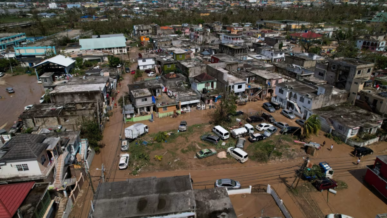
New satellite images obtained from Vantor reveal the scale of the devastation left by Hurricane Melissa after it slammed into Jamaica. The storm, which made landfall on Tuesday as a monstrous Category 5 hurricane, left a broad path of destruction before moving on to Cuba and the Bahamas.
Thank you for reading this post, don't forget to subscribe!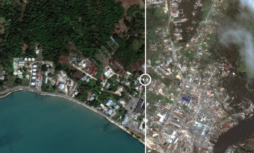
Coastal Communities Devastated
The images capture widespread flooding and extensive damage, particularly along the island’s coastline.
- St. Elizabeth Parish: Melissa first struck near Black River, tearing the roof clean off one of the town’s largest markets. Further along the southwest coast in the town of White House, where the local economy relies on the sea, small fishing boats were violently washed ashore, and remote fishing villages were nearly flattened by the catastrophic winds.
- Jamaica’s Breadbasket Submerged: As the storm tracked north, St. Elizabeth’s low-lying farmlands—Jamaica’s primary agricultural region—were quickly submerged. Satellite photos taken less than 24 hours after the floodwaters rushed in show vast swathes of stripped vegetation and inundated agricultural land.
Montego Bay Flooded
On the opposite side of the island, Montego Bay in St. James Parish also sustained heavy damage. Satellite views confirm extensive urban flooding, with large pools of water accumulating around storage facilities at the city’s main port.
As Melissa moved out to sea, the storm-driven currents pulled massive amounts of debris and muddy water out through the Barnett and Pye Rivers, which appears as a large, distinct cloud of dirty water visible off the Montego Bay shoals.